A quiet evening watching the sun goes down at Pasir Panjang jetty.
As dusk approaches the sky turns blue.
View Pasir Panjang Jetty in a larger map
Friday, May 25, 2012
Monday, May 21, 2012
Rocks of Tanjung Batu Nisan
The rocky cape of Tanjung Batu Nisan or
Cape of the Tombstone Rock is a popular snorkeling
and dive spot of the Perhentian Kecil Island.
Its name most probably came from the tombstone like rock
which is lying dangerously at the edge of a cliff there.
RIP...
A taxi boat speeding past.
An abandoned chalet which is about 5 minutes walk through a jungle path from Long Beach.
Balcony view.
The rocky beach viewed from the Long Beach jetty.
Many thing to see here for snorkelers
View Long Beach,Perhentian Kecil in a larger map
RIP...
A taxi boat speeding past.
An abandoned chalet which is about 5 minutes walk through a jungle path from Long Beach.
Balcony view.
The rocky beach viewed from the Long Beach jetty.
Many thing to see here for snorkelers
View Long Beach,Perhentian Kecil in a larger map
Friday, May 18, 2012
Segamat Railway Station
The old and faithful Segamat Railway station
is located
conveniently beside the town's new transport terminal.
It's future as a main mode of transport stands bright
with future double tracking and electrification project
after the completion of the Seremban to Gemas tracks.



A view of the old Segamat Railway bridge build by the British in 1933,
this 43m Steel Pratt Girder Type bridge
is still in use till today but its future is at stake
when the double tracking continues south.
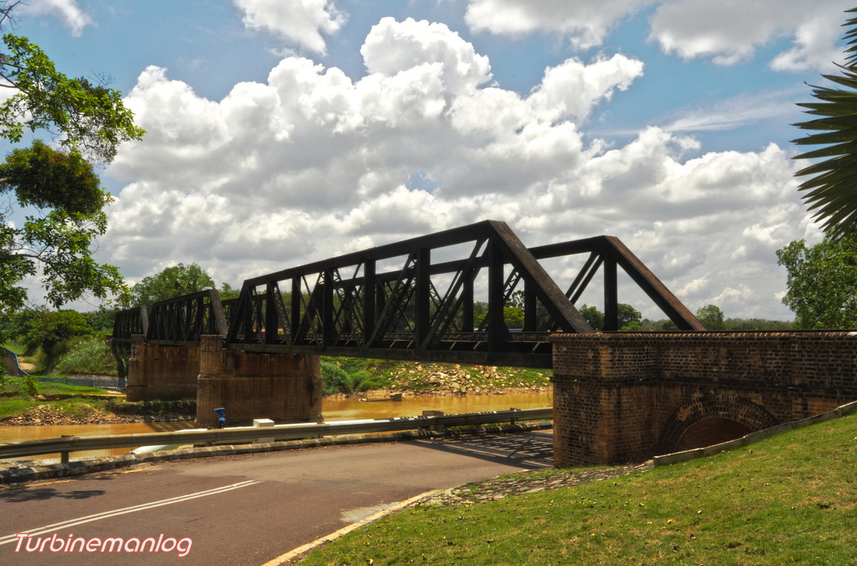
View from under the bridge.


View Segamat Railway Station in a larger map
conveniently beside the town's new transport terminal.
It's future as a main mode of transport stands bright
with future double tracking and electrification project
after the completion of the Seremban to Gemas tracks.


A view of the old Segamat Railway bridge build by the British in 1933,
this 43m Steel Pratt Girder Type bridge
is still in use till today but its future is at stake
when the double tracking continues south.
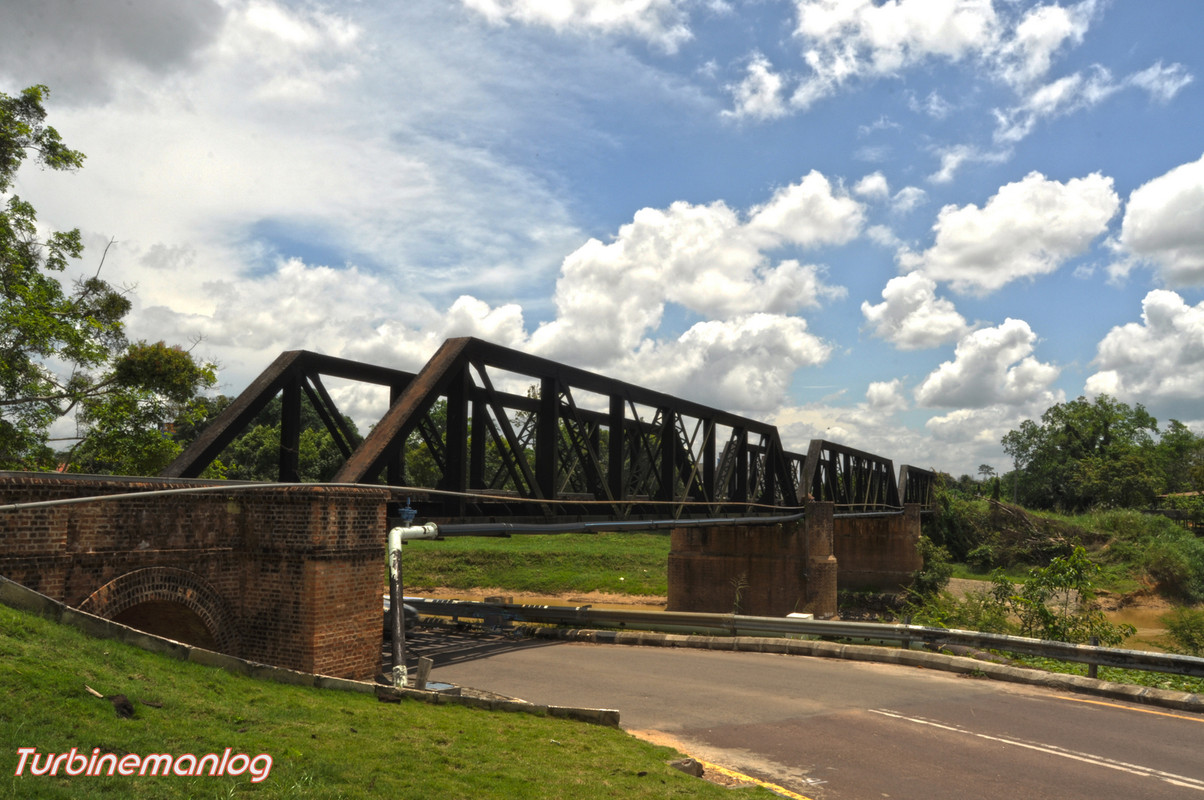 |
| Add caption |

View from under the bridge.


View Segamat Railway Station in a larger map
Monday, May 14, 2012
Romantic Beach of Perhentian Kecil Island
Romantic Beach as the name goes is one very beautiful and secluded beach
which will promise an unforgettable romance of a life time,
that's provided you bring your partner along.
Situated on the western side of the Perhentian Kecil Island and
is accessible by taxi boat or by a 30 minutes walk.
The 30 minutes walk from Long Beach in Pulau Perhentian Kecil
first through the path leading to Coral Bay and then turning right when you see the electrical pole number 50 up the 100m hill where the two Wind Turbine are located and then after going around the fence and passing the peak with a breathtaking view of Telok Kerma and its jetty,continue walking along the path down the hill.
The elevation of the climb.
This is where to take the turn and a long uphill walk from pole 50 to 1.
and follow the poles up the hill,notice the soil erosion is quite bad here.
A signboard at the fence of the Wind Turbine.
The collapsed jetty and Telok Kerma,a diving spot at the far end.
The fragile ecosystem of this small island looks threatened
with soil erosion cause by the access road to the Wind Turbine from the Romantic Beach below
and corals will choke and die when this soil flows down to the beach as muddy water.
A path to D lagoon for those who prefer walking than the 5 minutes taxi boat.
This was the landing area for the barge for the Wind Turbine and Solar panels installation work.
List of Hotels in Perhentian Kecil
View Long Beach,Perhentian Kecil in a larger map